Harvest Forecast: Wet Weather To Dampen Michigan
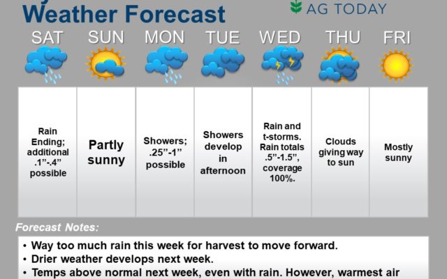
Plentiful (some would even say excessive”) moisture coming across Michigan over the coming week to 10 days. Harvest will clearly have some challenges to overcome in this period.
Showers begin to nose back into western Michigan overnight Sunday night through Monday with rain potential of .25”-1” and coverage at 90%. Once again, moisture winds down Monday afternoon.
Tuesday daytime rains stay well to the north, and we should see some drying over areas from I-96 south. But, then moisture sags slowly south through the state overnight. The slow south movement and then nominal flow along the boundary will trigger some bigger rains. We expect rain totals to be .5”-1.5” over 100% of areas from I-96 south Tuesday night through Thursday morning.
Drier weather comes back the balance of Thursday with clouds slowly dissipating, then full sunshine next Friday. Clouds will be on the increase Saturday the 5th, before another round of rain and thunderstorm action develops overnight Saturday night through Sunday. That front triggers rains up to half an inch, coverage 100%.
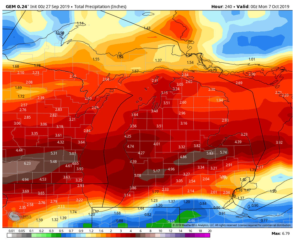
Temps generally above normal for the coming 10-day period, but that front at midweek next week does drop temps some. We do not have a concern about frost anywhere over the southern 2/3rds of Lower Michigan, but it will be significantly cooler than the start to the week. Really, in regards to harvest, it is all about the moisture (too much of it) for the next 10 days. The map below confirms that, as it shows 10 day rain totals for Michigan.
Extended Period:
For the extended 11-16 day period, we are back to a fully dry outlook. We have plenty of sun with no threat of rain for Monday the 7th through Saturday the 12th. Temps do pull back some for that period, and will be normal to slightly below.
Weeks 3 & 4:
Both week 3 and week for seem to have only minor frontal boundary activity moving through. This should lead to good harvest windows, and on average only one threat of rain each week.
Week 3
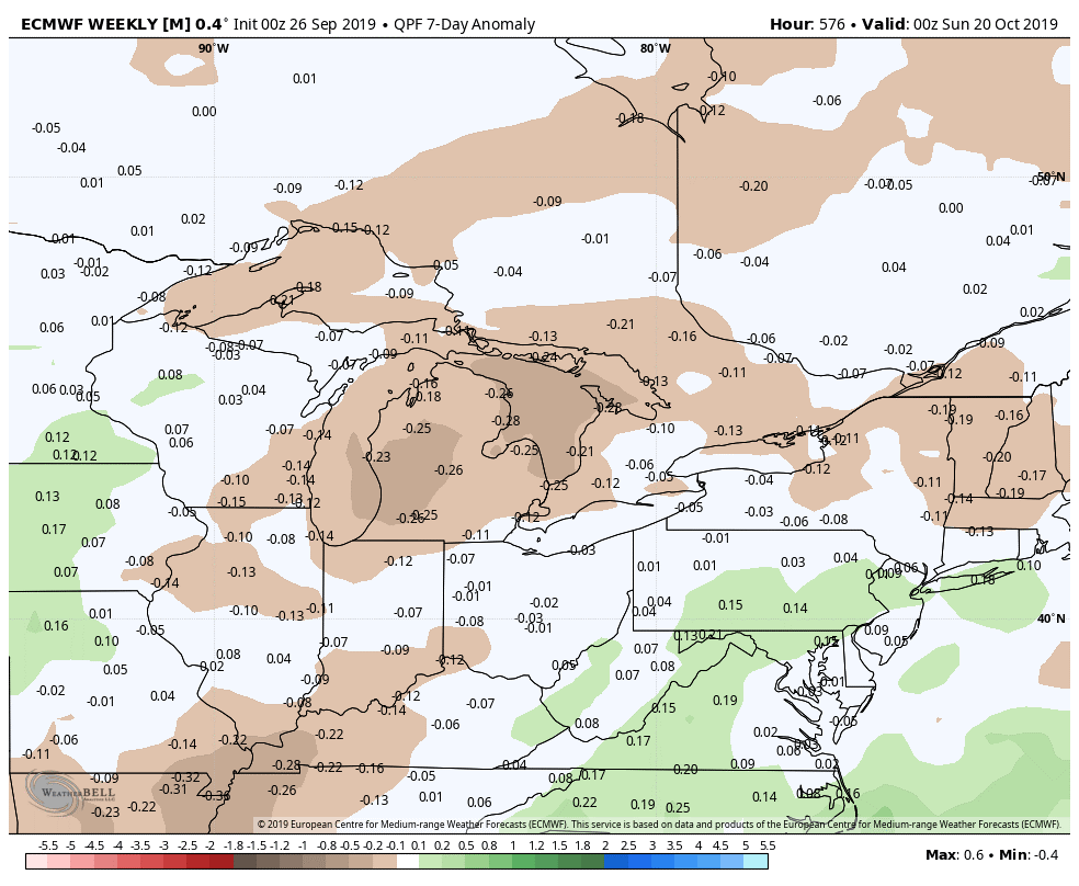
Precipitation, week ending September 20 (green: above normal, brown: below)
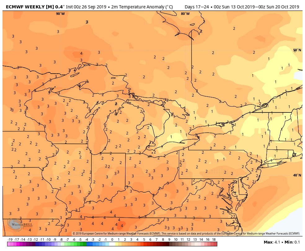
Temperature, Week ending September 27 (orange: above normal, blue: below)
Week 4
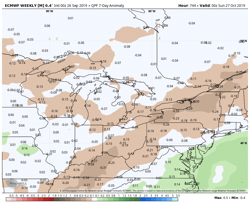
Precipitation, Week ending September 27 (green: above normal, brown: below)
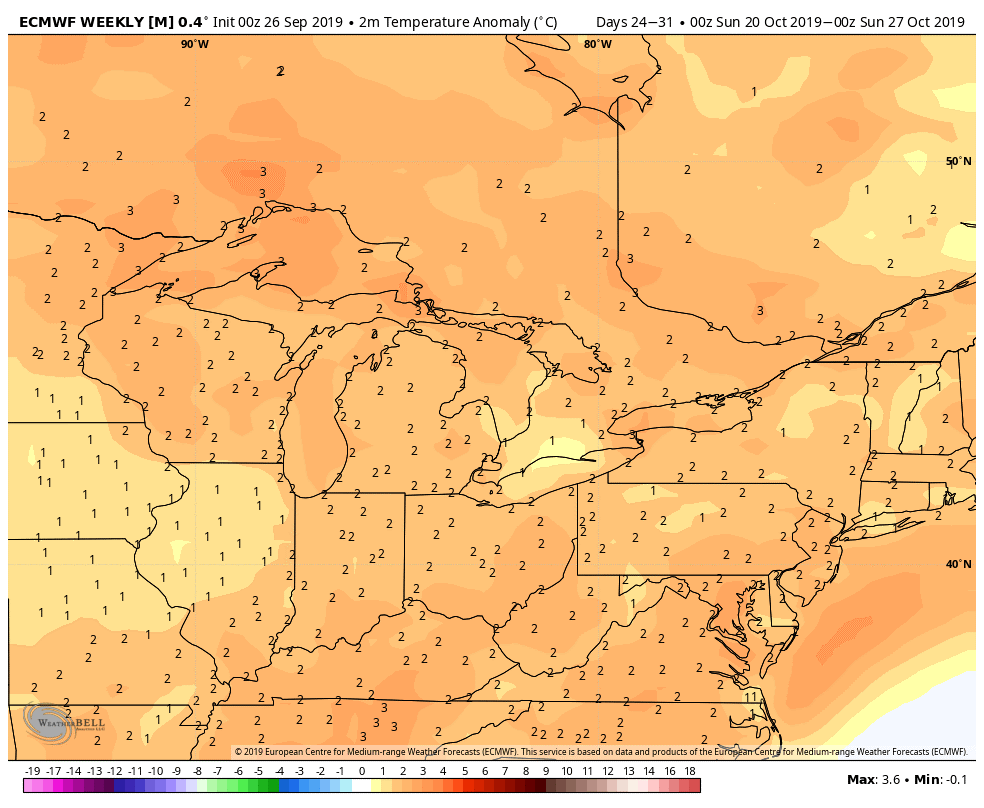
Temperature, Week ending September 27 (orange: above normal, blue: below)

Related Content